Back to Main Salmon Ridge Sno-Park page
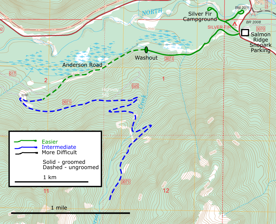
The Anderson Creek Road is directly across the Mt. Baker Highway from the Salmon Ridge SnoPark parking lot. (see notes below on how to find the entrance.) It has been groomed in the past, then during the winter of 2021-22 there were a lot of trees down on it, but those are cleared off and it *IS* currently being groomed out to the washout, 0.9 miles out. (as of 12/17/2022) The trail to the washout is a nice rolling trail with modest hills and turns. I think it’s a fun ski. It also seems to hold snow a little longer than Razor Hone – frequently there is skiing on it in April (at least with old skis.)
Beyond the washout, it stays relatively level for another mile, then turns and goes uphill for a couple of miles, all an old Forest Service road which is starting to grow in with brush. It is certainly appropriate for a back-country skiing and snowshoeing – but there are three patches of downed trees that are sort of a mess. We are hoping to do a work party up there this winter, either late December or January to cut notches through for skiers. Let Pete know if you’d like an invite.
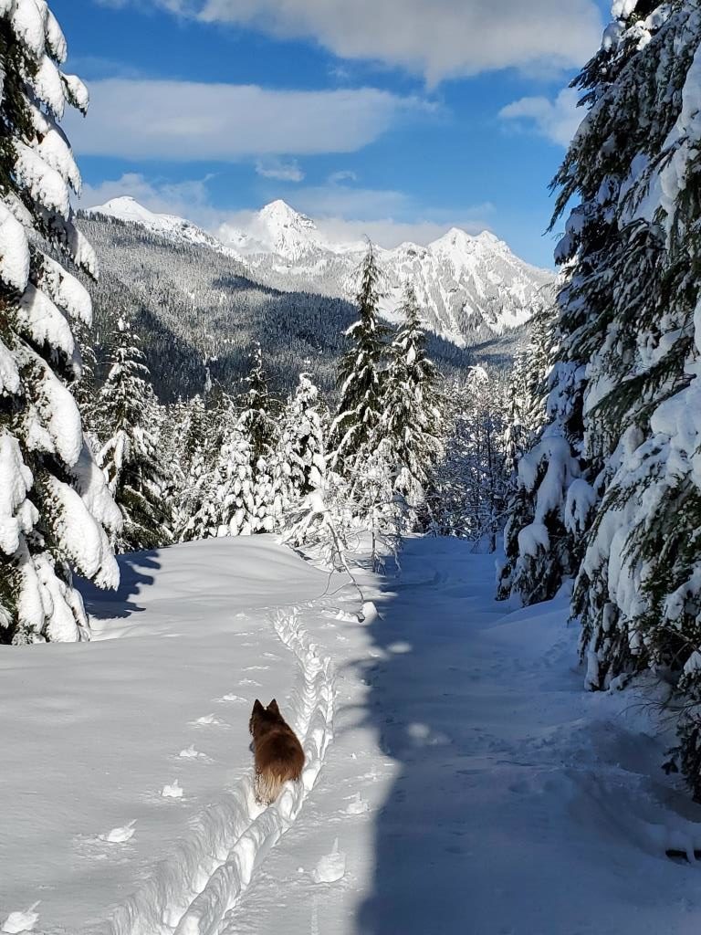
A report from last winter gives an idea of what you might find further up the trail: (Feb. 2022): “Today I went out Anderson Creek trail and found that the upper part is just fantastic. There is now a track pretty much the full length of the road. The culverts at the washout have washed away. Crossing the stream is actually easier than before. Snow is very thin in some areas of dense cover about 1.5 miles out. Bare patches soon. Last prior tracks at 2.25 miles just past the first big switchback, I was breaking trail after that. About a half dozen notable dead falls between 2.5 and 3 miles. I was able to cross all of them without removing skis. After about 3 miles the road magically clears, no problematic deadfalls beyond, just endless fluffy white goodness. Fantastic alpine views beyond about 4 miles. At 5.1 miles just short of the end of the road there’s a big open slope above and below the road, I chose not to cross because of potential avalanche hazard.” – James
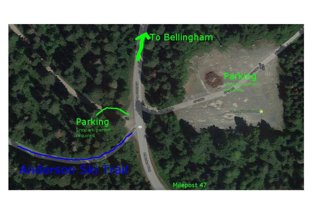
How to find it: The first map below shows the entrance to the trail. When first looking for it, many people go down the road into the campground which dead-ends in a nice area, which is usually groomed and an excellent beginner area and a nice place to poke around. But to find Anderson, when you are next to the Forest Service sign, look to your left. There is a snowberm – climb over that berm and you should immediately see the trail (a snow-covered Forest Service road). If you pass through a gate 100 feet up the road, you are going in the right direction.
The 2nd map shows the general outline of the trail. The trail has nice smooth rolling gradient for the first couple of miles. There is a washout at 0.9 mile. Up to that point, it is appropriate for most any skiers. It’s great for skate skiing – it sometimes has classical tracks, but not always. No trailwork has been done beyond the washout – but it is interesting territory to explore and after the switchback at mile 2, a chance to gain elevation. Look behind you – you will be skiing back down the same way!
I went 4+ miles up Anderson on August 11, 2022. See pictures on this shared Google Photo page. Further comments to be typed here shortly